After a few days of R&R in the tourist town of San Pedro de Atacama, I was ready for more riding. I wanted to explore the Bolivian Altiplano, a region of southwestern Bolivia largely above 4000 m in altitude and famous for its colourful lakes (lagunas), flamingoes, volcanoes and desolate landscape. After over 3 months of travelling in Chile and Argentina, I was excited to finally move on to a new country!
Recently I have decided to make Sucre, the constitutional capital of Bolivia, the endpoint of my South American cycling trip. Four months on two wheels have been a wonderful experience but now I feel ready for something new. To reach Sucre, I decided to ride part of the famous lagunas route on Bolivia's southwestern border with Chile, then head east to Volcan Uturuncu and finally north to the town of Uyuni on the edge of the Salar de Uyuni - the world's largest salt flat. The way from Uyuni to Sucre is still a work in progress...
As soon as I crossed into Bolivia, the contrasts with Argentina and Chile were striking. The people are poorer, the way of life is more simple. Faces and hands are worn, tanned and wrinkled by the bright sun and bitter wind. Life is hard at 4000 m above sealevel! Fruit and vegetables are scarce (almost non-existent in the villages, except for the odd onion or maize). Meals are heavy on starch (potatoes or rice) and meat (llama or chicken) The older generation wear traditional clothes. Particularly the older women stand out, with their wide-brimmed sunhats (or curious little bowler hats), heavy shawls against the cold, knee or ankle length skirts and stockings, often paired with sandals. The street stalls and market stands are almost exclusively run by women. There is no such thing as organised childcare or government support for the elderly. Infants either play on the ground or are wrapped up tightly against the cold and carried on their mothers´ backs. Older children are expected to help out, even late into the night. Elderly women scrape by selling simple items in the market, The contrast between the country people and the urbane-looking individuals I've seen on Bolivian TV could not be starker.

San Pedro de Atacama at dusk - 100 percent gringo-town.
Heading to the Bolivian border. Goodbye sealed roads, welcome back ripio.
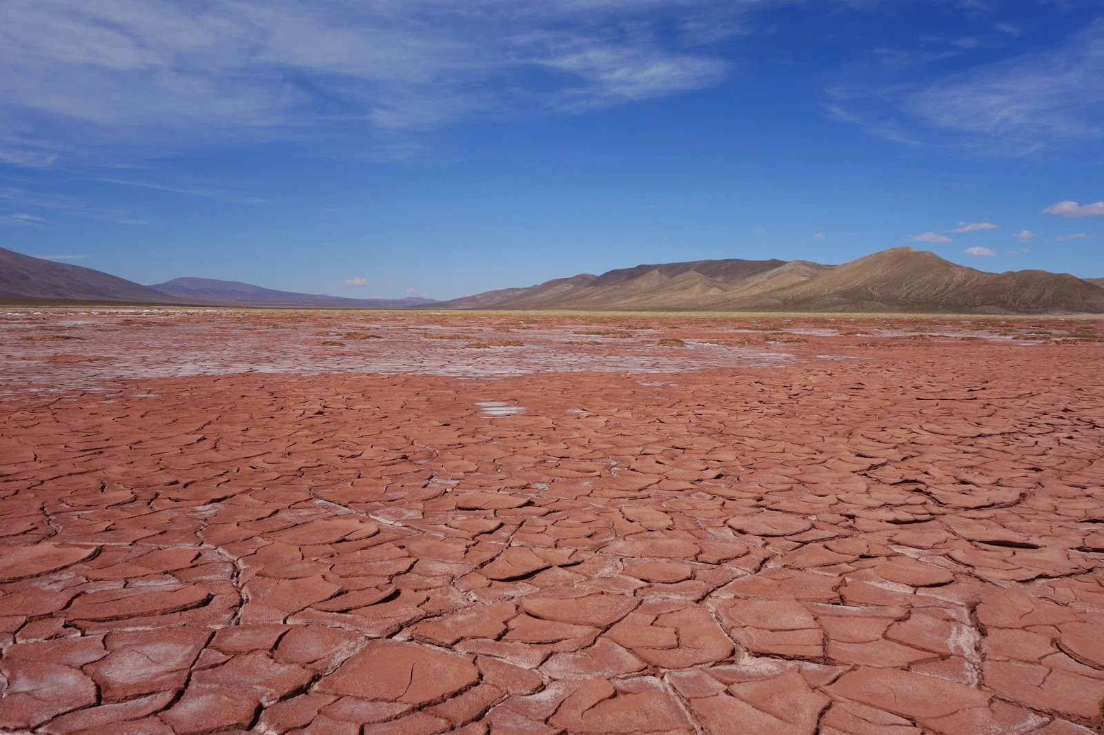
The landscape of the Altiplano is barren and quite dramatic...
Shortly after passing Bolivian immigration, Laguna Blanco (R) and Laguna Verde (distant L) come into view.
Pictures don't really do it justice, but Laguna Verde is an amazing place.
The going is tough on Paso del Condor.
Luckily there are some hotsprings just down the road in Polques!
And for the first time since the Carretera Austral in Chile, I met multiple touring cyclists in Polques - 3 Swiss guys and two French couples.
The next day, I rode with the three Swiss guys (Fede, Beni and Raphael). Near the geysers at Sol de Manana, the way took us up to nearly 5000 m above sealevel.
Sol de Manana - an interesting high-altitude geothermal area of steam geysers and mudpools.
The aforementioned mudpools. I took care where I walked as there are no barriers - and help is a long, long way away.
Laguna Colorada and lots of flamingoes - definitely a highlight on the Lagunas route. The coloration of the lakes in the region comes from various minerals in the runoff from the surrounding mountains and also algal blooms.
Sadly after just a day of riding, I parted ways with the 3 Swiss guys and made my way to the 6008 m Volcan Uturuncu - the highest mountain in the Sud Lipez region. It is easily recognisable by its dual summits.
Llamas are everywhere to be found along the route....
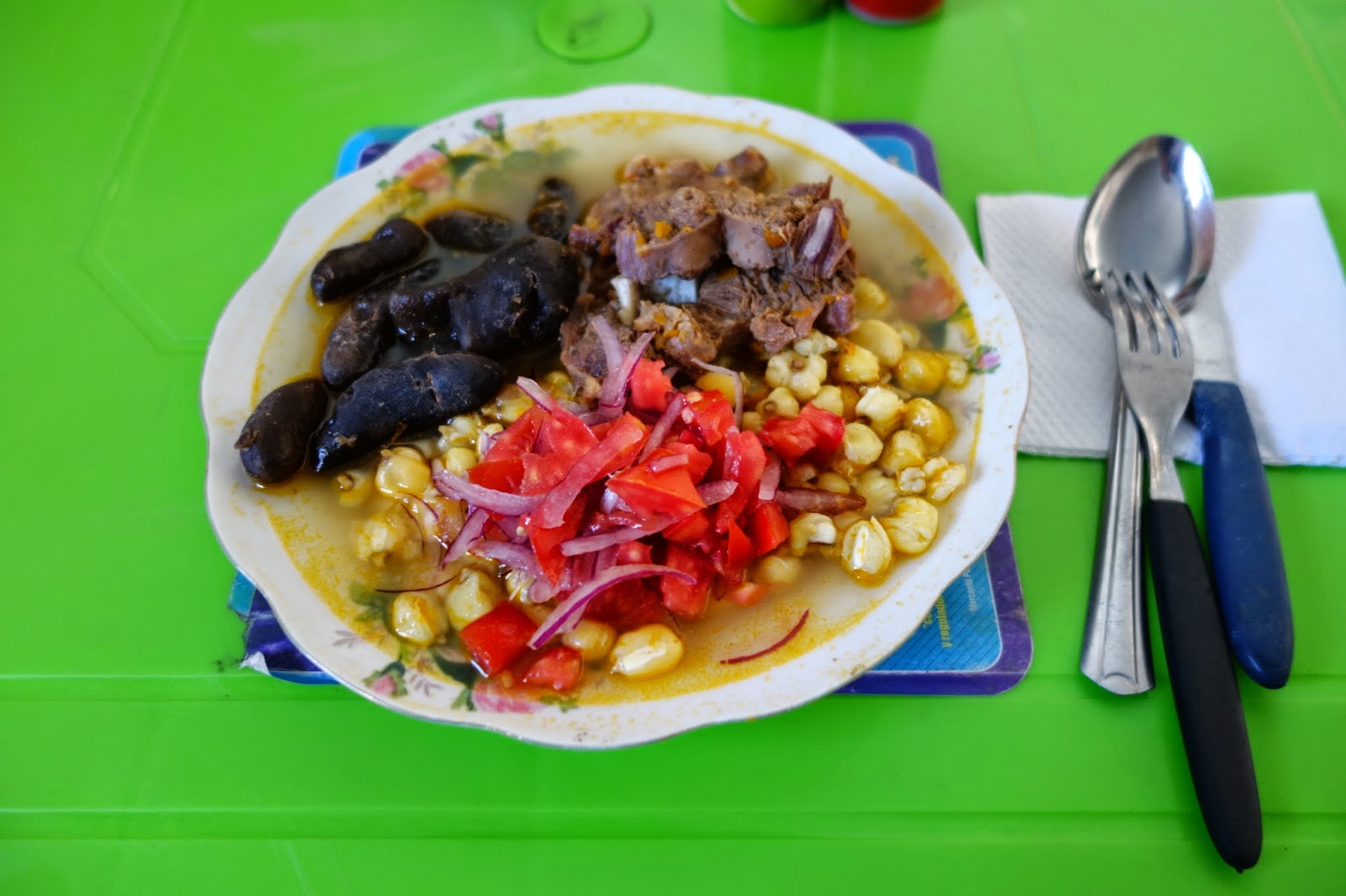
...and usually end up on a dinner plate. This is a typical local meal with llama, maize, onion, tomato and small dark potatoes.
After one night in the litte village of Quetena Chico, I rode to the base of Uturuncu and set up camp for the night. Windy and freezing cold, I didn´t leave my tent once the sun disappeared.
Next morning, my goal looked much more achievable. The rideable track leads all the way to the col between the twin summits. Topping out at 5760 m, this is one of the highest roads ever built.
But it goes without saying, it was tough work to ride the bike at this altitude, even lightly loaded. I walked much of the way above 5000 m, huffing and puffing quite a bit. The view made up for a lot!
Finally, I reached the col at 5760 m. The summit was just 250 m higher up. An easy hike usually, but I was alone on the mountain, there were strong winds and the way up was steep and icy, so I decided to head back down.
One last view from the col, out towards another impressive volcano to the left. Unfortunately I don't know its name. It was a long way back to Quetena Chico, and I arrived in the dark.
Next day, I pushed on to the little village of Villamar, arriving at dusk. The volcano catching the last sun of the day is the same as the one in the previous picture.
Some interesting rock formations on the way to the town of Alota.
In the end I never stopped in Alota, but caught a strong tailwind 58 km further to San Christobal. I hung around at the little market the next morning enjoying the warm sun and some yummy empanadas.
Empanadas by the boxful!
With a full stomach, I rode the rather monotonous main road to Uyuni, Next stop: Salar de Uyuni.